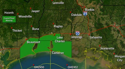
NWS Lake Charles weather update: 9 a.m. 1.10.20
Published 9:18 am Friday, January 10, 2020
1 of 3
We are still expecting strong to severe storms later tonight into tomorrow morning. This evening we should see scattered pop up showers and thunderstorms across southeast Texas and western Louisiana, some of which could be severe. After midnight, an organized line of strong to severe storms will move west to east across our region.
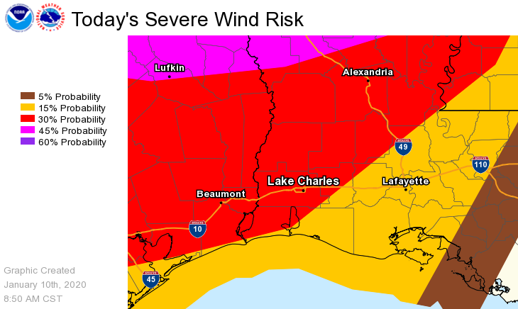
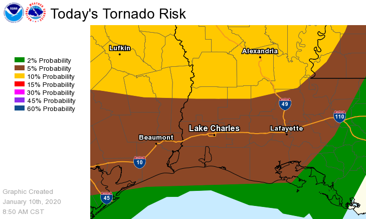
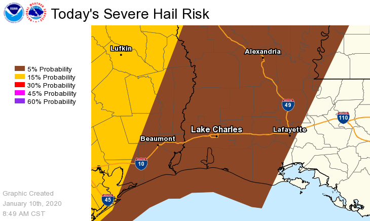
The latest severe weather risk areas for tonight are outlined in the following graphics.
Tornado: the highest risk is in east Texas and central Louisiana.
Damaging winds: the highest risk is in southeast Texas and southwest and central Louisiana.
Hail: the highest risk is in southeast Texas.
Please note these graphics are valid through 6 am Saturday. The tornado and damaging wind risk will extend across south central Louisiana after 6 am Saturday morning.