Excessive rainfall, severe storms possible for Orange County
Published 8:23 am Sunday, March 24, 2024

|
Getting your Trinity Audio player ready...
|
There is a Marginal Risk (level 1 of 4) for excessive rainfall and a Slight Risk (level 2 of 5) for severe storms on Monday.
The main hazards are damaging wind gusts and tornadoes.
A squall line is expected to develop ahead of a cold front before pushing through the region Monday. The squall will push through the area from west to east from approximately 10 a.m. through 11 p.m.
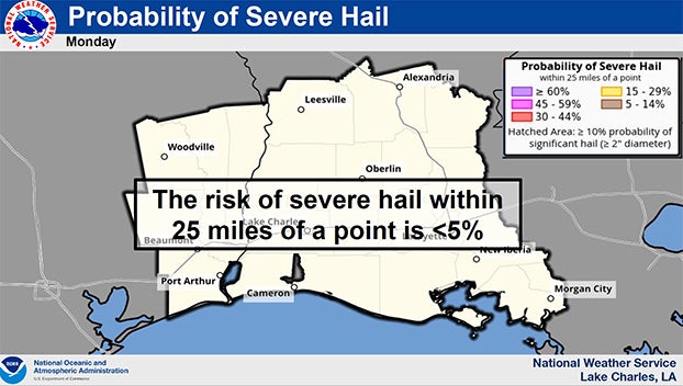
Conditions are generally favorable for some of the storms within the squall line to become severe with tornadoes, damaging winds and large hail all possible. In addition, periods of heavy rainfall could lead to localized street flooding although rainfall totals are not expected to be high enough to threaten homes. Graphics depicting the threat are attached.
The risk area is for Southeast Texas and Southwest Louisiana.
A low pressure moving across the region is bringing about scattered to numerous showers and thunderstorms starting Monday morning with activity exiting the region Tuesday morning.
(Courtesy of the National Weather Service)