National Weather Service outlines severe weather threat, timelines for today and Saturday
Published 10:27 am Friday, November 4, 2022

|
Getting your Trinity Audio player ready...
|
On Friday morning, the National Weather Service stressed there is an enhanced to slight risk of severe weather expected Friday evening through Saturday morning.
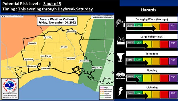
(Courtesy of the National Weather Service)
There is a marginal risk of excessive rainfall Friday evening through Saturday morning.
The main concern will be damaging wind gusts and hail, with an isolated risk of tornadoes.
Heavy rain of 1 to 2 inches with locally higher amounts, possibly causing flooding of low lying areas is possible.
Part of an Enhanced Risk (3 out of 5) clips parts of Tyler and Jasper Counties.
All Southeast Texas counties as well as a majority of southwest Louisiana parishes reside in the Slight Risk (2 out of 5).
The Marginal Risk (1 out of 5) of Excessive Rainfall covers the entire area.
Showers will begin Friday afternoon, increasing in coverage and intensity this evening and overnight with the cold frontal passage.
The greatest risk for severe weather will occur late Friday evening and extend into Saturday morning, going west to east across the area.