National Weather Service outlines severe weather risk, timing for SETX
Published 4:55 pm Wednesday, November 2, 2022

|
Getting your Trinity Audio player ready...
|
According to the National Weather Service, there is a slight risk of severe weather expected this week due to a cold frontal passage.
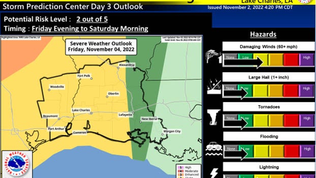
(Courtesy of the National Weather Service)
The main concerns are damaging wind gusts; however, there is an isolated risk of hail and tornadoes.
Heavy rain is expected, and flooding of low lying areas is possible.
All Southeast Texas counties, as well as a majority of southwest Louisiana parishes reside in the Slight Risk (2 out of 5), which is where the greatest threat is likely set up.
A Marginal Risk (1 out of 5) covers the remainder of the region’s southwest Louisiana parishes.
Showers will begin Friday afternoon, increasing in coverage and intensity thereafter. The greatest risk for severe weather occurs late Friday and extends into Saturday morning, going west to east across the area.