NWS Lake Charles weather update: 4 a.m. 12.23.20
Published 7:23 am Wednesday, December 23, 2020
1 of 2

|
Getting your Trinity Audio player ready...
|
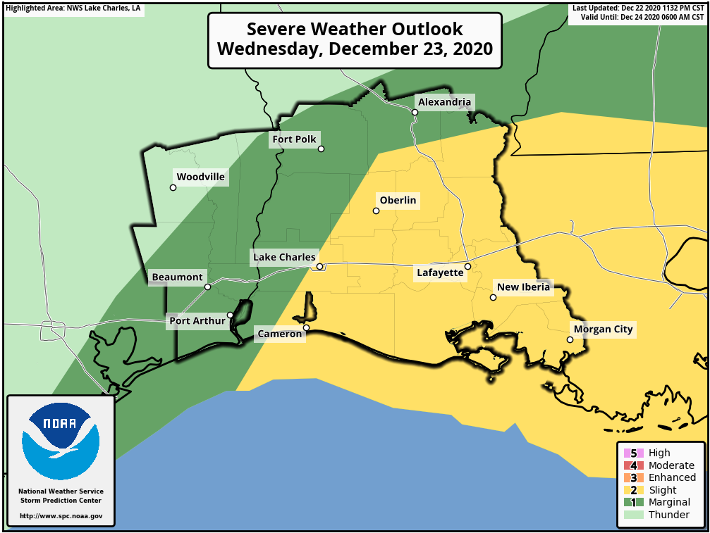
A strong cold front will move through our region this afternoon and tonight. Heavy rain and thunderstorms are expected.
There is a slight (15%) risk for severe storms in most of southwest, south central, and central Louisiana, while there is a marginal (5%) risk for southeast Texas.
Damaging winds, large hail, and a tornado are all possible.
In addition, during periods of heavy rain, roads may become impassable. It is harder to determine flooded roads during night hours. One to three inches of rain is expected.
Behind the cold front, strong northerly winds will be sustained near 20 mph, with gusts in the 30s later tonight into parts of tomorrow. A few power outages and tree damage is possible.
For marine interests, a gale warning is in effect for late tonight through tomorrow. A low water advisory is also in place for the Sabine-Neches, Calcasieu, and Vermilion Bay regions late tonight through tomorrow morning.


