**Weather Update** 10 a.m. 08.28.2020: Bands of Thunderstorms Will Produce Frequent Lightning, Possible Flooding Today
Published 10:48 am Friday, August 28, 2020
1 of 3
|
Getting your Trinity Audio player ready...
|
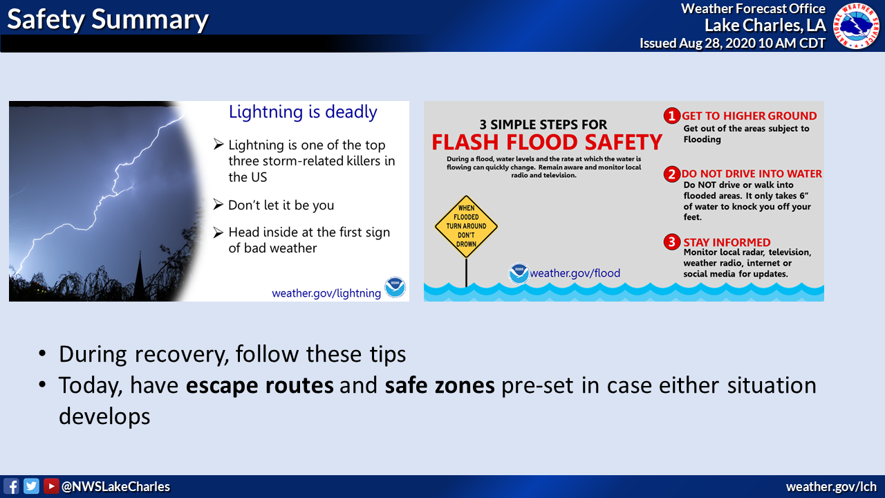
Here is a quick update to the weather situation. Our main concern is for public safety folks on the ground in recovery, as well as the population at large.
Overview
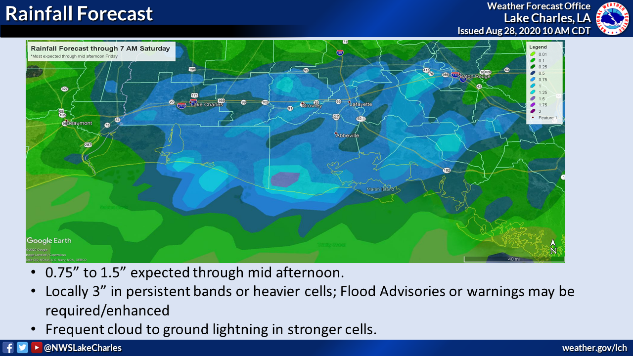
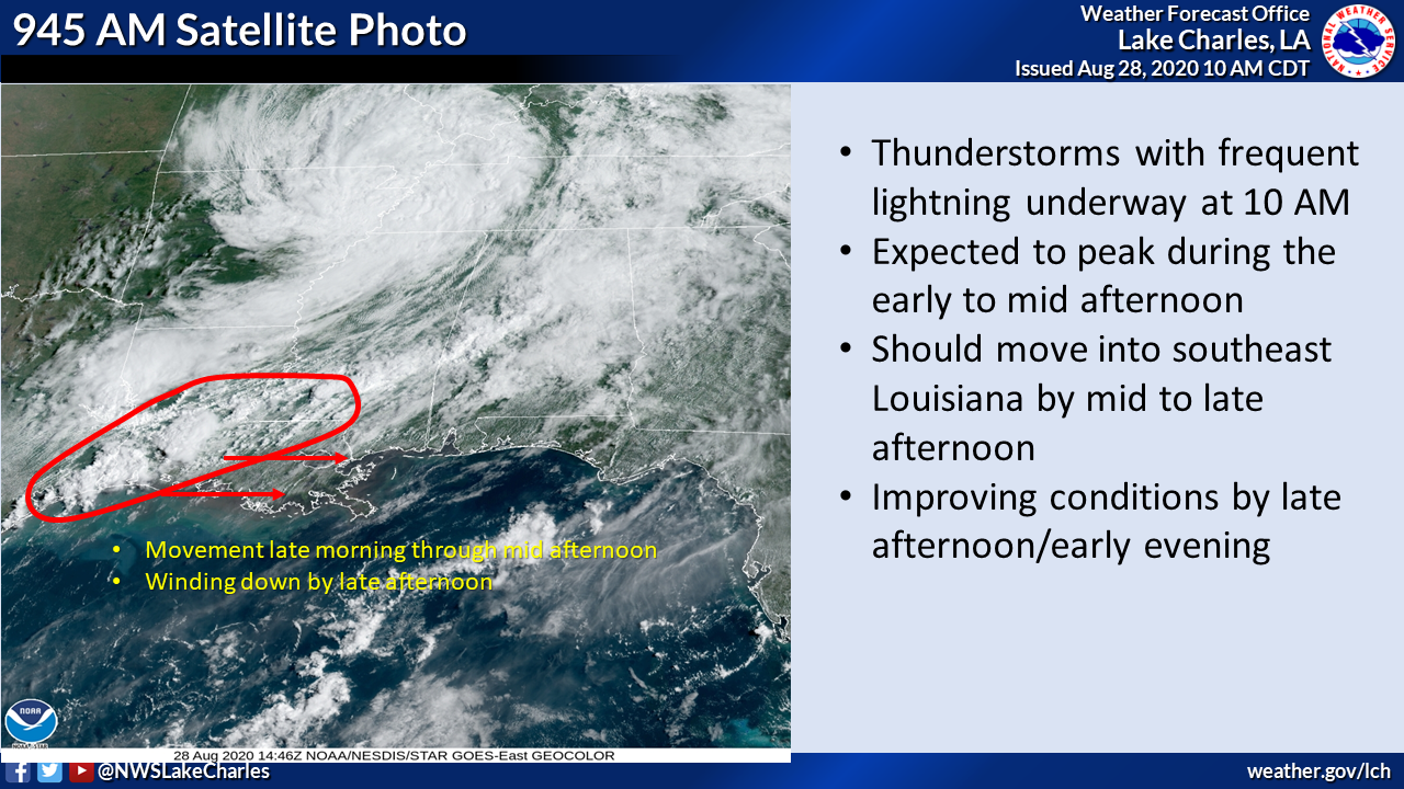
A developing band of thunderstorms extended from southern Mississippi across central and southwest Louisiana into extreme southeast Texas at 10 AM. Thunderstorms will continue to develop in clusters along the line this morning, with the entire area moving through the Acadiana area from late morning through early to mid afternoon. Slow-moving cells, stronger cells, and any “training” cells (moving along the same path over several hours) will produce frequent cloud to ground lightning and could create new minor flooding or exacerbate any active flooding, especially along/south of I-10.
Timing/Impacts
- The storms should peak in intensity between 2 and 4 PM, then slowly wind down between 4 and 6 PM
- Nuisance flooding of poor drainage areas not currently impacted by residual high water; exacerbated flooding in areas already under high water
- Water depth could reach 3 feet or higher in pre-flooded areas where 3+ inches of rain occur in a short period of time.
- Frequent lightning will require brief cessation of recovery efforts to keep people safe.
Stay tuned for possible flood advisories or additional warning through the afternoon.