NWS Lake Charles tropical update: 1:30 p.m. 9.23.19
Published 1:44 pm Monday, September 23, 2019
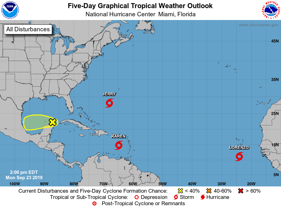
PRESS RELEASE — The National Hurricane Center is monitoring a weak area of low pressure just northeast of the Yucatan Peninsula. The system is forecasted to move slowly westward through this week and has a low (20%) chance of development. At this time, this system is expected to move into northeast Mexico by this weekend.
The main impact will be higher than normal tides through this week. By late this week, there will be increased threat for coastal flooding. We will have minimal rain chances through this week. However, as this system approaches northeast Mexico, rain chances will increase this weekend.
Elsewhere, the tropical Atlantic remains active. Tropical Storm Jerry is expected to move further east of the U.S. Tropical Storm Lorenzo is just off the African coast. Current long term forecasts show Lorenzo remaining over the central or eastern Atlantic. Finally Tropical Storm Karen will affect Puerto Rico on Tuesday and continue north through most of the week. We will likely need to continue to monitor Karen through at least early next week as long term forecasts suggest a westward movement toward the U.S. beginning this weekend.