NWS Lake Charles tropical update 10 a.m. 9.3.19
Published 10:22 am Tuesday, September 3, 2019
1 of 2
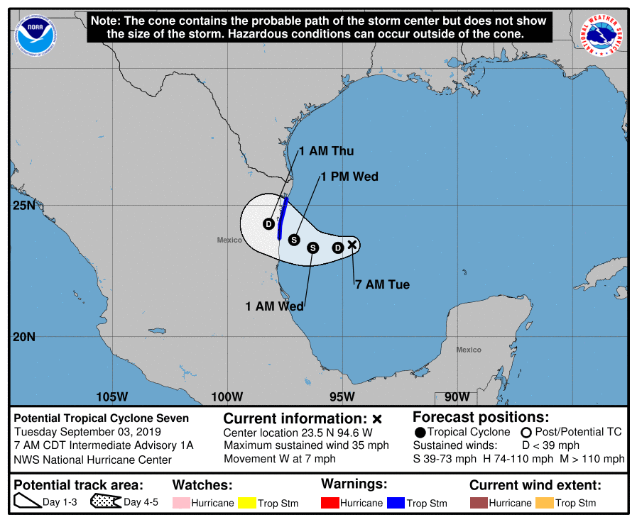
The National Weather Service is monitoring newly formed Tropical Depression 7 located over the southwest Gulf of Mexico. By Wednesday night, this system is forecasted move inland over northeast Mexico as a tropical storm. The main impacts locally will be minor coastal flooding as tides may reach a foot above normal.
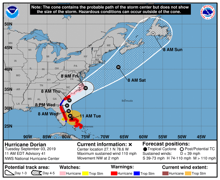
Dorian has weakened to a Category 3 hurricane over the last 24 hours as it slowly moves northwest of the Bahamas. The latest forecasts have Dorian remaining a major hurricane through Wednesday before weakening. It is expected to move up the Atlantic coast from Florida through the Carolinas over the next several days. For coastal areas along its path, Dorian is expected to cause damaging winds and major storm surge. It is not expected to impact our area.
Two other potential tropical systems are further out in the Atlantic, and none of them pose any threat to us over the next week.
The next storm name will be Fernand followed by Gabrielle.