NWS Lake Charles weather update: 10 am Wed 6.5.19
Published 10:39 am Wednesday, June 5, 2019
1 of 3
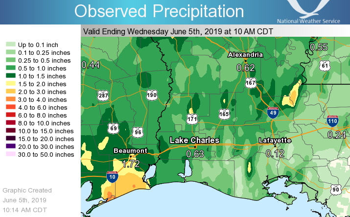
PRESS RELEASE — We have seen one to three inches of rain fall so far in southeast Texas, and more is on the way.
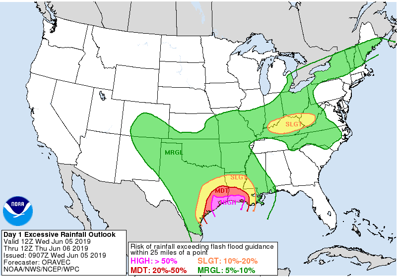
For today through tomorrow, an additional one to five inches of rain is expected for east Texas and central Louisiana, while four to ten inches of rain is expected along and south of the I-10 corridor of southeast Texas, southwest, and south central Louisiana. Expect to see street flooding during periods of heavy rain today through Thursday. The highest risk areas are seen in the day 1 excessive rainfall outlook which is for today and tonight, where there is a high chance for flash flooding for southeast Texas, southwest and south central Louisiana. The day 2 excessive rainfall outlook for Thursday continues to highlight south central Louisiana as a moderate threat for flash flooding.
Along the rivers, we are expecting minor river flooding along Pine Island Bayou near Sour Lake and Bevil Oaks, the Neches River from Evadale down to the Salt Water Barrier, the Sabine River near Deweyville, and the Calcasieu River at Old Town Bay, Salt Water Barrier, and Sam Houston Jones State Park. Moderate flooding continues on the Atchafalaya River at Morgan City.
A coastal flood advisory continues for tides running one to one and a half foot above normal. During periods of high tides expect to see some minor coastal flooding.


