TS Cindy expected to make landfall Thursday
Published 4:25 pm Wednesday, June 21, 2017
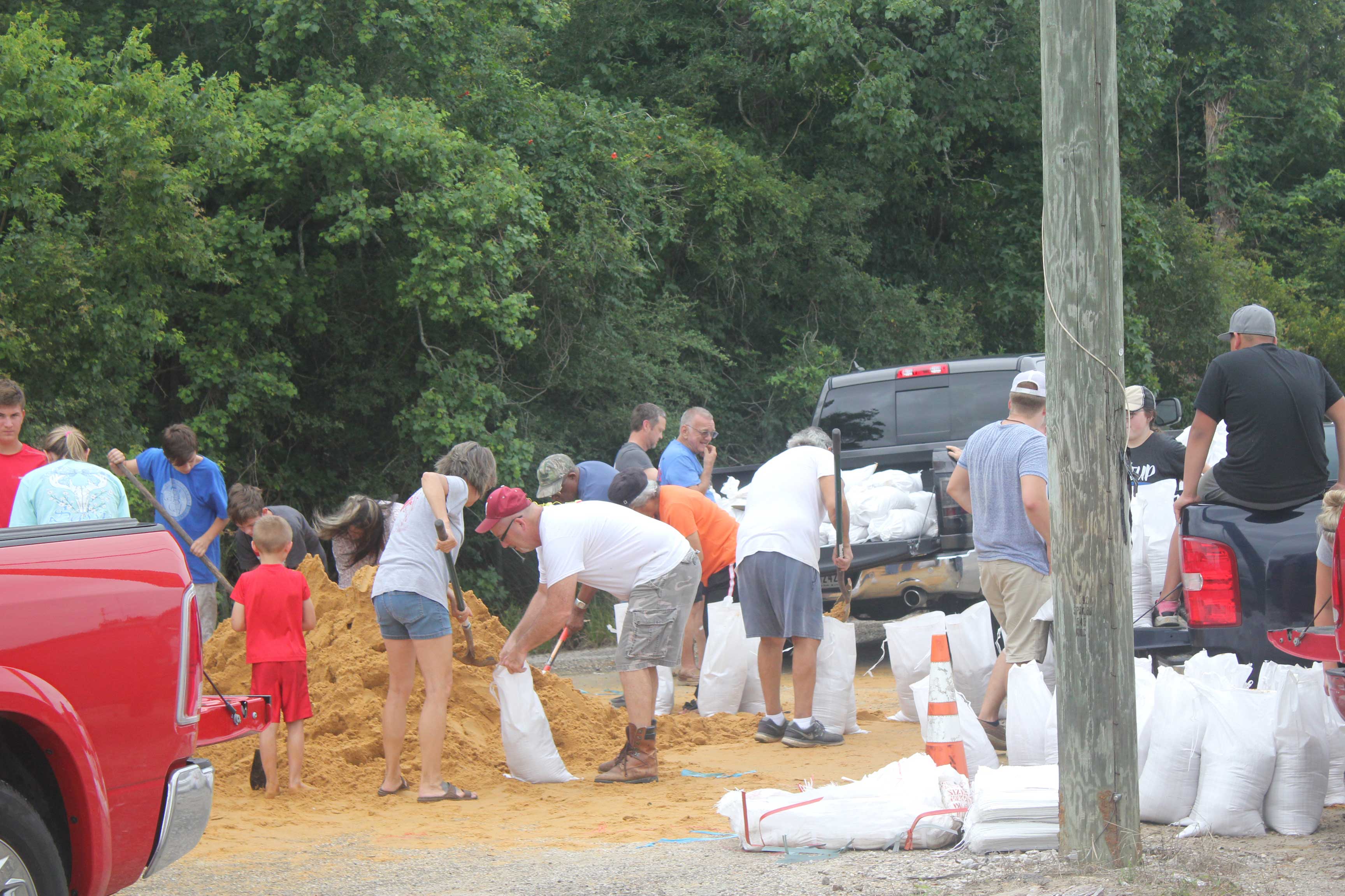
- Dawn Burleigh/The Orange Leader Residents filled sandbags at Precinct 3 County Maintenance Barn located at 2502 West Roundbunch Road in Bridge City.
By Dawn Burleigh
The Orange Leader
With expected 50 mph sustained winds expected, the main preparations for Tropical Storm Cindy is securing items in ones yard.
American Red Cross was making preparations for the worse while hoping for the best on Wednesday.
Volunteers were on site at the Orange location loading the disaster vehicle in case emergency shelters were needed due to the impending Tropical Storm Cindy.
People living in the path of this storm should keep informed about weather conditions and listen to the advice of local officials. Finalize your emergency kit and evacuation plan and know how your community will respond. Download the free Red Cross Emergency App to access the latest weather alerts on your mobile device and find emergency shelters. Search for American Red Cross in your smartphone app store or by going to redcross.org/apps.
Your emergency kit should include a gallon of water per person, per day, non-perishable food, a flashlight, battery-powered radio, first aid kit, medications, supplies for an infant if applicable, a multi-purpose tool, personal hygiene items, copies of important papers, cell phone chargers, extra cash, blankets, maps of the area and emergency contact information.
If someone already has a disaster kit, now is the time make sure the food and water is still okay to consume and that copies of important documents are up to date. If they already have an emergency plan for their household, they should talk about it again with family members so everyone knows what to do if an emergency occurs.
Plan routes to local shelters, register family members with special medical needs as required and make plans for pets., according to Red Cross.
At the bottom of the article are three checklists to help prepare for the storm.
“We are expecting winds, not rain,” Orange County Judge Brint Carlton said as he was waiting to hear the latest updates. “Last we were told, we could expect 50 mph sustained winds.”
Sand and bags are available at:
Pct. 1 County Maintenance Barn – North State Hwy. 87 at North Teal
Pct. 2 County Maintenance Barn – 2600 Lawrence Road
Pct. 2 Commissioners Office at 11867 State Hwy. 62 (across from Market Basket in Mauriceville)
Pct. 3 County Maintenance Barn – 2502 West Roundbunch Road in Bridge City
Pct. 4 County Maintenance Barn – 375 Claiborne Street
Residents must bring their own shovel and are welcomed to bag the sand to use to protect their homes from rising water.
In other closings, Vidor ISD has issued a statement concerning classes and activities:
Due to the possibility of inclement weather tomorrow, Vidor ISD has cancelled all student classes and activities for Thursday, June 22. Staff will report as usual, but students will not.
Students at Vidor High School taking STAAR tests will take those tests on Monday.
If your student was enrolled in cooking camp through VISD Community Education, the camp will conclude on Monday from 1:30-3:30.
Girls’ basketball camp will finish on Monday, same times as this week.
Summer reading camp will resume on Monday at 9 a.m. as usual.
According to the 4 p.m. update from the National Hurricane Center, the center of Tropical Storm Cindy was located near latitude 28.2 North, longitude 93.2 West. Cindy is moving toward the northwest near 9 mph (15 km/h). A turn toward the north-northwest is expected tonight and Thursday, with a turn toward the northeast expected on Friday. On the forecast track, the center of Cindy will move inland over southeastern Texas or southwestern Louisiana late tonight or early Thursday, then move near or over extreme eastern Texas, western and northern Louisiana, and southeastern Arkansas Thursday and Thursday night. Maximum sustained winds are near 50 mph (85 km/h) with higher gusts. Little change in strength is expected before landfall, with weakening expected thereafter. Tropical-storm-force winds extend outward up to 115 miles (185 km) from the center. The estimated minimum central pressure based on observations from oil rigs near the center is 994 mb (29.36 inches).
Tropical storm conditions should spread westward and northward through the Tropical Storm Warning area this afternoon through Thursday.
Returning home after a hurricane or flood