Squall line expected to form and move into Southeast Texas with severe storms potential
Published 6:43 am Tuesday, February 7, 2023
- (Courtesy of the National Weather Service)
|
Getting your Trinity Audio player ready...
|
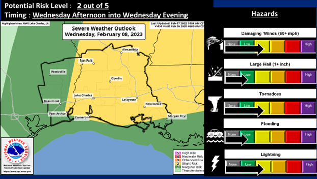
According to the National Weather Service, as of Tuesday morning, there remains a Slight Risk Potential (level 2 out of 5) for severe storms this week.
The main hazards are damaging straight line wind gusts and/or quick spin up tornadoes along a possible squall line.
There is also a Marginal Risk Potential (level 1 out of 4) for excessive rainfall that may lead to flooding.
Some of the storms may produce locally 1 to 2 inches of rainfall in a short period of time.
This combined with already wet soils will bring a small potential for flooding.
The Slight Risk for severe storms is for areas east of roughly a Toledo Bend to Port Arthur line, with a marginal risk for the remainder of the area.
The Marginal Risk for excessive rainfall is for the entire area.
A squall line is expected to form Wednesday afternoon and move into Southeast Texas, then continue to move eastward in Louisiana during the late afternoon into evening hours.