Friday update. National Weather Service outlines next week’s severe weather threat.
Published 10:15 am Friday, December 9, 2022

|
Getting your Trinity Audio player ready...
|
The National Weather Service continues to update Orange County residents and the rest of Southeast Texas about the potential for severe weather early next week.
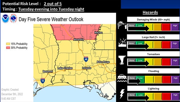
(Courtesy of The National Weather Service)
Weather watchers say a storm system early next week will bring the potential for severe weather to much of the Southern Plains.
All modes of severe weather will be possible, including damaging wind gusts, large hail and a few tornadoes.
A slight risk (level 2 out of 5 or between 15 and 29 percent chance) exists for nearly all of the region.
The timing has slowed down a bit, with isolated to scattered thunderstorms likely developing through the early evening hours on Tuesday, with some of these storms possibly having supercell characteristics.
A squall line of strong to severe storms will then develop and move through Tuesday night into early Wednesday morning.
“Since we are still a number of days out, these details may change, so continue to monitor this weather situation,” according to the National Weather Service.