National Weather Service details severe thunderstorm threat for Saturday and next week
Published 3:46 pm Friday, November 25, 2022

|
Getting your Trinity Audio player ready...
|
The National Weather Services outlines the potential for heavy rainfall and severe weather Saturday and another potential round of severe weather on Tuesday.
1 to 3 inches of rainfall with locally higher amounts that may fall in a short period of time that has the potential to produce flooding.
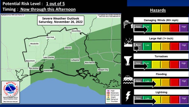
(Courtesy of the National Weather Service)
There is a slight risk potential for excessive rainfall (level 2 out of 4.)
Severe weather potential is a marginal risk (1 out of 5) for storms to have a potential for damaging winds, quick spin up tornadoes, and occasional cloud to ground lightning.
Excessive rainfall is expected across the entire area of Southeast Texas and southwest and south central Louisiana through the morning hours Saturday, then ending from west to east during the afternoon.
Next week
The National Weather Service, as of Friday at 3:30 p.m., announced there is increasing risk for strong to severe thunderstorms Tuesday into Wednesday morning.
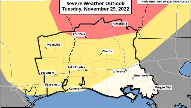
(Courtesy of the National Weather Service)
Strong to severe thunderstorms are possible across much of the area as a cold front crosses the region.
Current forecast models indicate an environment that could support all storm modes and hazards within a highlighted area.
Severe storms are most likely in the Enhanced Risk area (red, below) with strong storms possible in the Slight Risk (yellow, below).
Details about expected storm hazards and areas of concern are likely to change/shift based on forecast changes moving closer to this event.