NWS Lake Charles flood and tropical update: 1 pm Sat 9.11.21
Published 1:22 pm Saturday, September 11, 2021
1 of 4

|
Getting your Trinity Audio player ready...
|
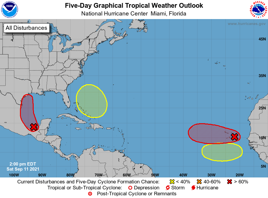
The National Hurricane Center has a high 90% chance for tropical development for the system in the Bay of Campeche.
A tropical depression or tropical storm is expected to form Sunday or Monday, and track north along the Mexico and Texas coast.
If it stays out over the water beyond Monday, it has the potential to be a category one hurricane before it reaches southeast Texas or southwest Louisiana.
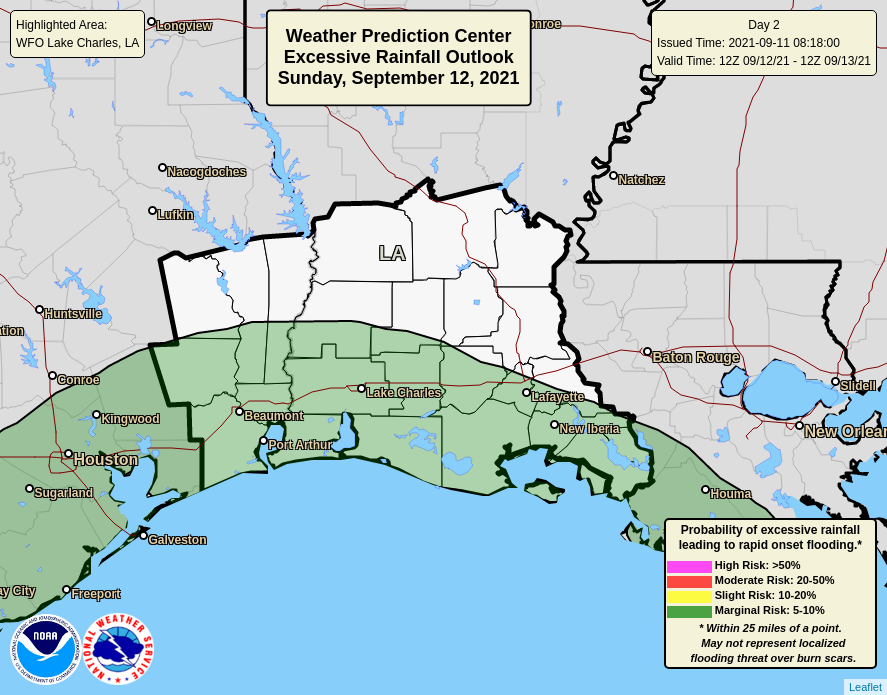
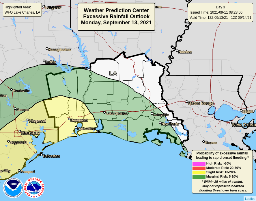
Regardless of if it becomes a tropical storm or hurricane, we are forecasting a significant amount of rain for southeast Texas and southwest Louisiana. Five to ten inches of rain is expected, with locally higher amounts of 15 to 20 inches possible. Expect to see street flooding during periods of heavy rain Monday and Tuesday, and potentially water entering homes and businesses.
With tides expected to be one to two feet above normal Monday and Tuesday, water will have a more difficult time to drain as well. Minor coastal flooding can be expected during high tides Monday and Tuesday.
Finally, winds will be gusty Monday and Tuesday in southeast Texas and southwest Louisiana. Gusts of 25 to 35 mph could blow down some tree branches and cause a few power outages.
There are other tropical systems trying to develop in the Atlantic. None of these will threaten us over the next week.