NWS Lake Charles weather update: 9:30 a.m. 5.18.21
Published 9:38 am Tuesday, May 18, 2021
1 of 3
|
Getting your Trinity Audio player ready...
|
Hazardous Weather Message
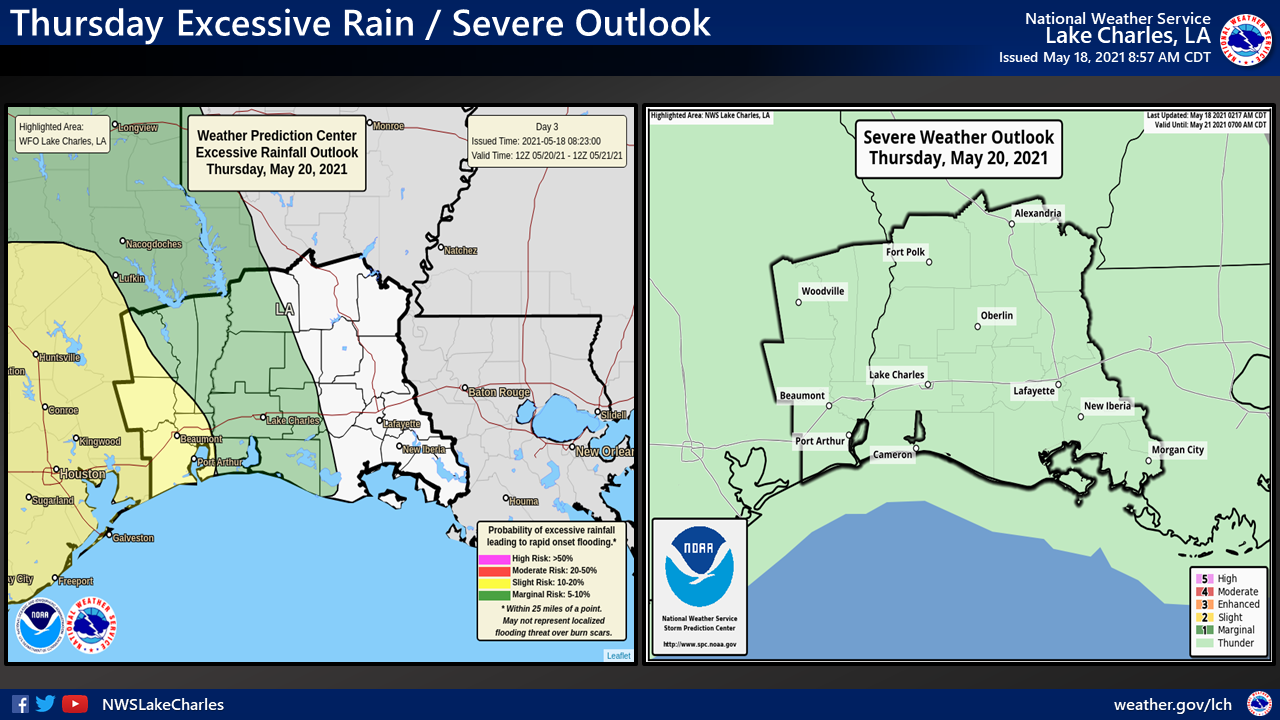
…SIGNIFICANT RAINFALL HAS RESULTED IN WIDESPREAD FLOODING AROUND THE REGION…
…CONTINUED PERIODIC HEAVY RAIN WILL LEAD TO MORE FLASH FLOODING, AS WELL AS SIGNIFICANT RIVER FLOODING…
IMPACTS:
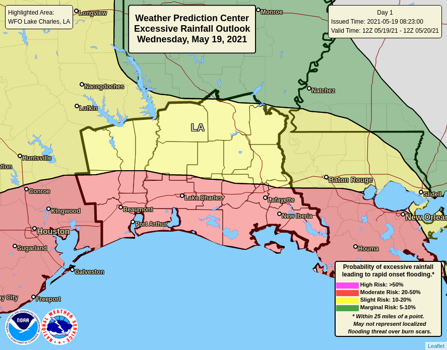
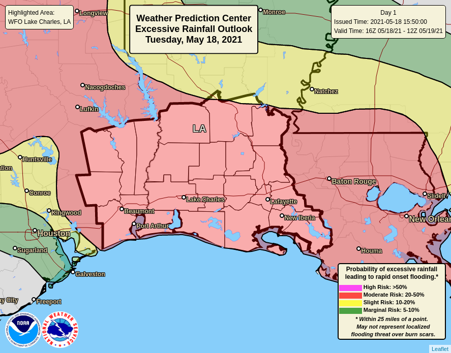
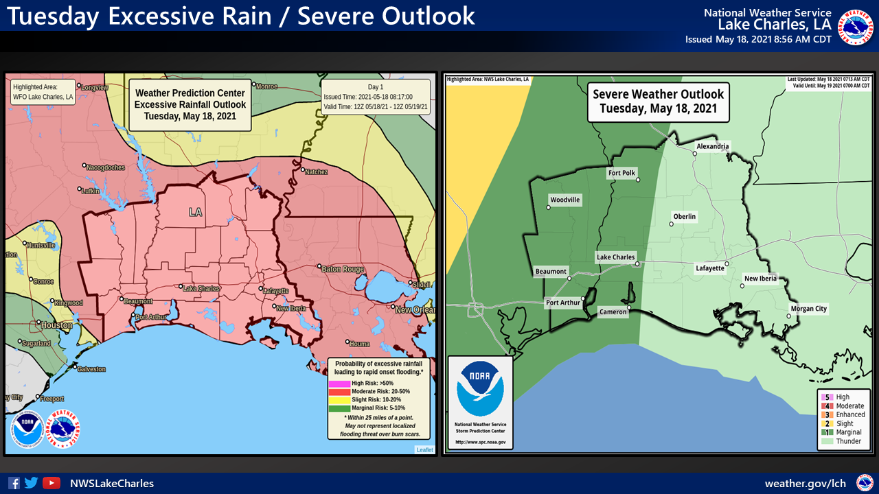
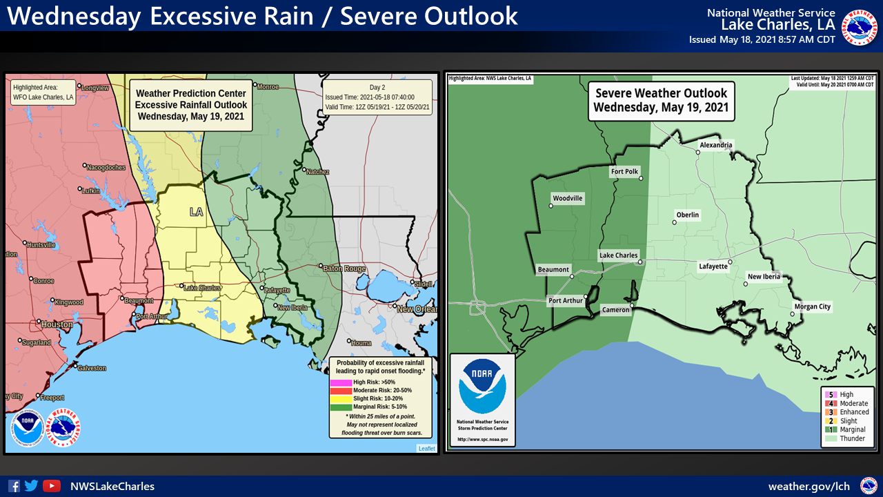
More bouts of heavy rain will result in likely flash flooding, especially in areas receiving heavy rain prior. Further rain totals of 5 to 10 inches with localized areas of 15 to 20 inches are still possible.
Most area rivers are in a state of flood, and further heavy rain will lead to further rises. The Calcasieu River at White Oak Park is currently above Major Flood stage. The Neches River at Saltwater Barrier and at Beaumont are forecast to rise above Major Flood stage Friday into this weekend.
Isolated severe weather will be possible today and tomorrow. Severe weather is not currently anticipated Thursday.
WHERE:
The entirety of the NWS Lake Charles forecast area with the highest chances in east Texas and west Louisiana.
WHEN:
Periodically through the next several days.