NWS Lake Charles weather update: 2:30 p.m. 2.14.21
Published 2:35 pm Sunday, February 14, 2021
1 of 2
|
Getting your Trinity Audio player ready...
|
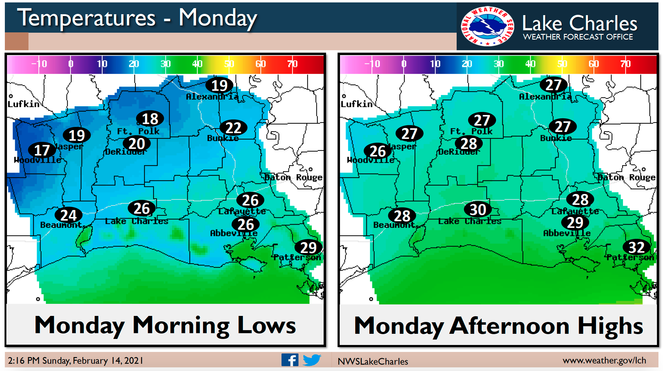
Hazardous road conditions are expected tonight through Monday, and could linger into Tuesday due to the cold temperatures.
Light rain starting now will transition to sleet and freezing rain as we go through tonight.
As the precipitation ends Monday morning, it will transition to snow.
Bitterly cold temperatures follow the precipitation, with lows Monday night in the single digits to teens.
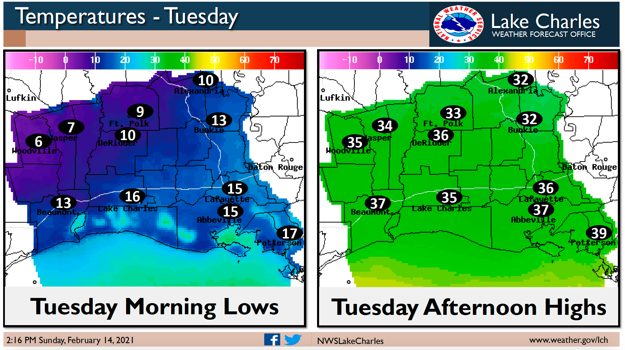
Tuesday brings no precipitation, but highs will only be in the 30s.
Tuesday night will see temperatures below freezing. Precipitation will start around midnight, and freezing rain is expected late Tuesday into early Wednesday.
Expected ice totals tonight through Monday morning: southeast Texas 0.10-0.25″, east Texas 0.10-0.25″, southwest Louisiana 0.25-0.50″, south central Louisiana 0.25-0.50″, and central Louisiana 0.20-0.50″.
Expected snow totals tonight through Monday afternoon: southeast Texas 1 inch or less, east Texas 2-4 inches, southwest Louisiana less than 1 inch, south central Louisiana less than 1 inch, and central Louisiana 1-2 inches.
Now is the time to finish preparing for this winter storm. Be careful and safe! Follow local officials’ advice on road traveling. Have a safe way to stay warm.