NWS Lake Charles tropical update: 4 p.m. 9.21.20
Published 4:49 pm Monday, September 21, 2020
|
Getting your Trinity Audio player ready...
|
Beta is looking more disorganized on radar and satellite. It is near the middle Texas coast. It will move little over the next 24 hours before drifting up the Texas coast towards our region Wednesday and Thursday as a tropical depression.
Wind gusts of 20 to 45 mph are expected, with the highest winds along and south of I-10 in southeast Texas and southern Louisiana.
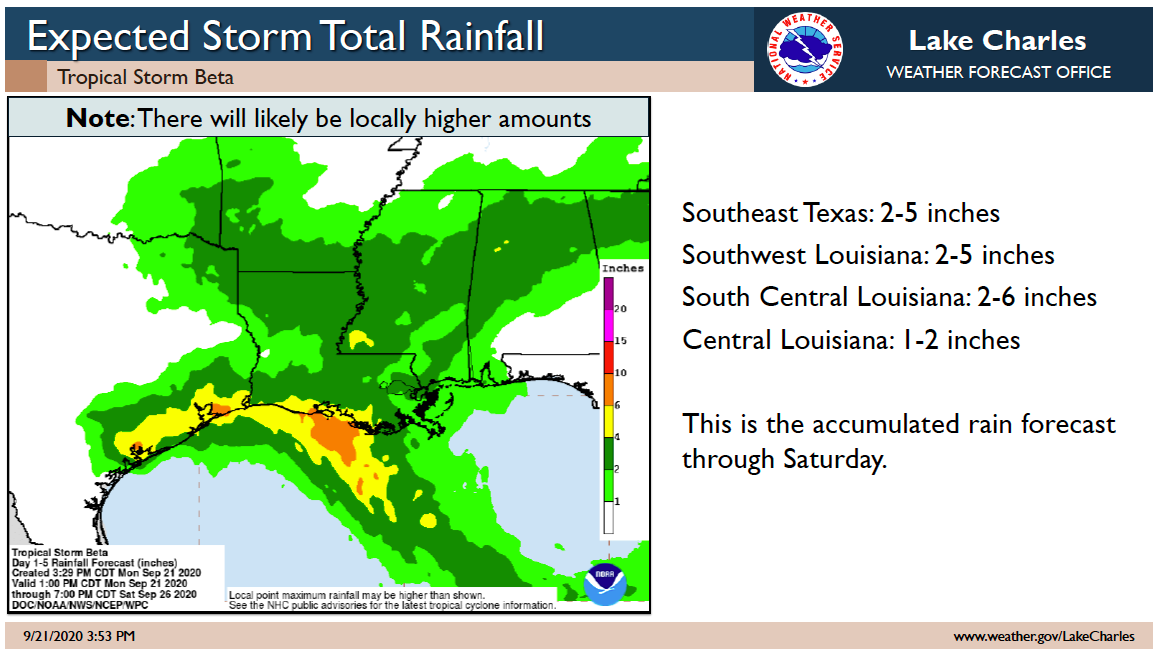
Rainfall totals will vary greatly this week across our region. Some places will see an inch or two. Other places could see ten inches or more. It will depend on where the rain bands set up each day this week. Flash flooding is possible where the heaviest rains fall.
Storm surge of one to three feet above ground level is expected during high tides across the coast of Texas and Louisiana tonight through Thursday.
There is a small threat for an isolated tornado in southeast Texas and southern Louisiana tonight and tomorrow.