NWS Lake Charles tropical update: 10 p.m. 8.26.20
Published 10:58 pm Wednesday, August 26, 2020
|
Getting your Trinity Audio player ready...
|
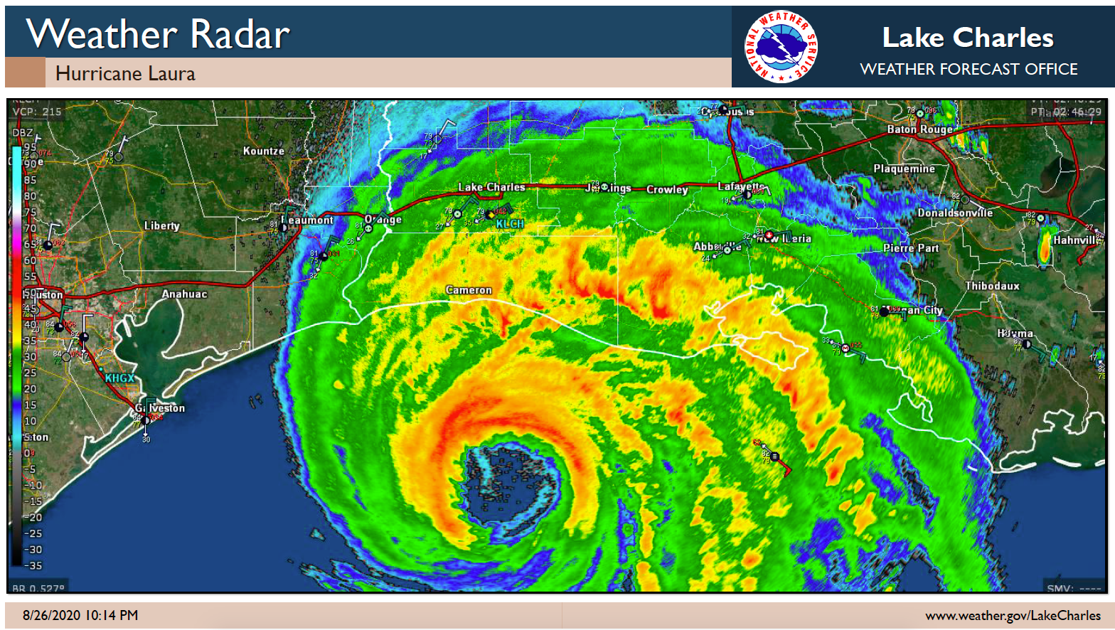
As of 10 p.m., Hurricane Laura is a high-end category four.
Location: 29.0°N 93.2°W
Moving: NNW at 15 mph
Min pressure: 939 mb
Max sustained: 150 mph
75 miles from Port Arthur, TX and Lake Charles, LA
The eyewall will be making landfall between midnight and 2 am. East of the center of circulation will see the highest storm surge and strongest winds.
Expect to see winds of 120+ mph near Lake Charles, LA as the eyewall moves through the area. Winds of 75 to 100+ mph are expected in southeast Texas. Winds of 50 to 75 mph are expected in south central Louisiana.
Storm surge in Lake Charles will be delayed until closer to sunrise. The combination of surge and rainfall will likely cause catastrophic flooding in this region.
If southeast Texas can stay west of the center of circulation, storm surge will be delayed until closer to sunrise as well. The storm surge will be in the 5 to 8 ft range in southeast Texas.
Storm surge in Vermilion Bay region has the potential to be in the 10 to 15 ft range still.