Potential storm surge predicted for Hurricane Laura
Published 12:32 pm Monday, August 24, 2020
|
Getting your Trinity Audio player ready...
|
Laura is expected to make landfall between southeast Texas and south central Louisiana as a category two hurricane late Wednesday or early Thursday.
Everyone should be preparing for a category three hurricane due to the typical hurricane forecast errors, especially when it comes to wind speeds.
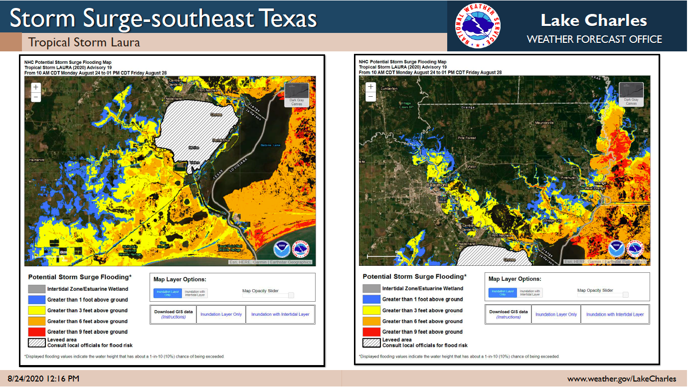
Here are the expected weather impacts from Laura:
Winds: Hurricane force winds will be possible across the region starting late Wednesday and continuing Thursday.
Storm Surge: At the coast, water could be over 10 feet above ground level. Depending on where Laura makes landfall, storm surge can back up rivers and bayous and flood over 30 miles inland.
Rainfall: Depending on where the rain bands form, 5 to 10 inches with locally 15 inches will be possible starting Wednesday into Thursday.
Tornadoes: Tornadoes will be possible in the eyewall as the hurricane approaches the coast, as well as outer rain bands.