NWS Lake Charles tropical update: 10 a.m. 7.25.20
Published 10:22 am Saturday, July 25, 2020
|
Getting your Trinity Audio player ready...
|
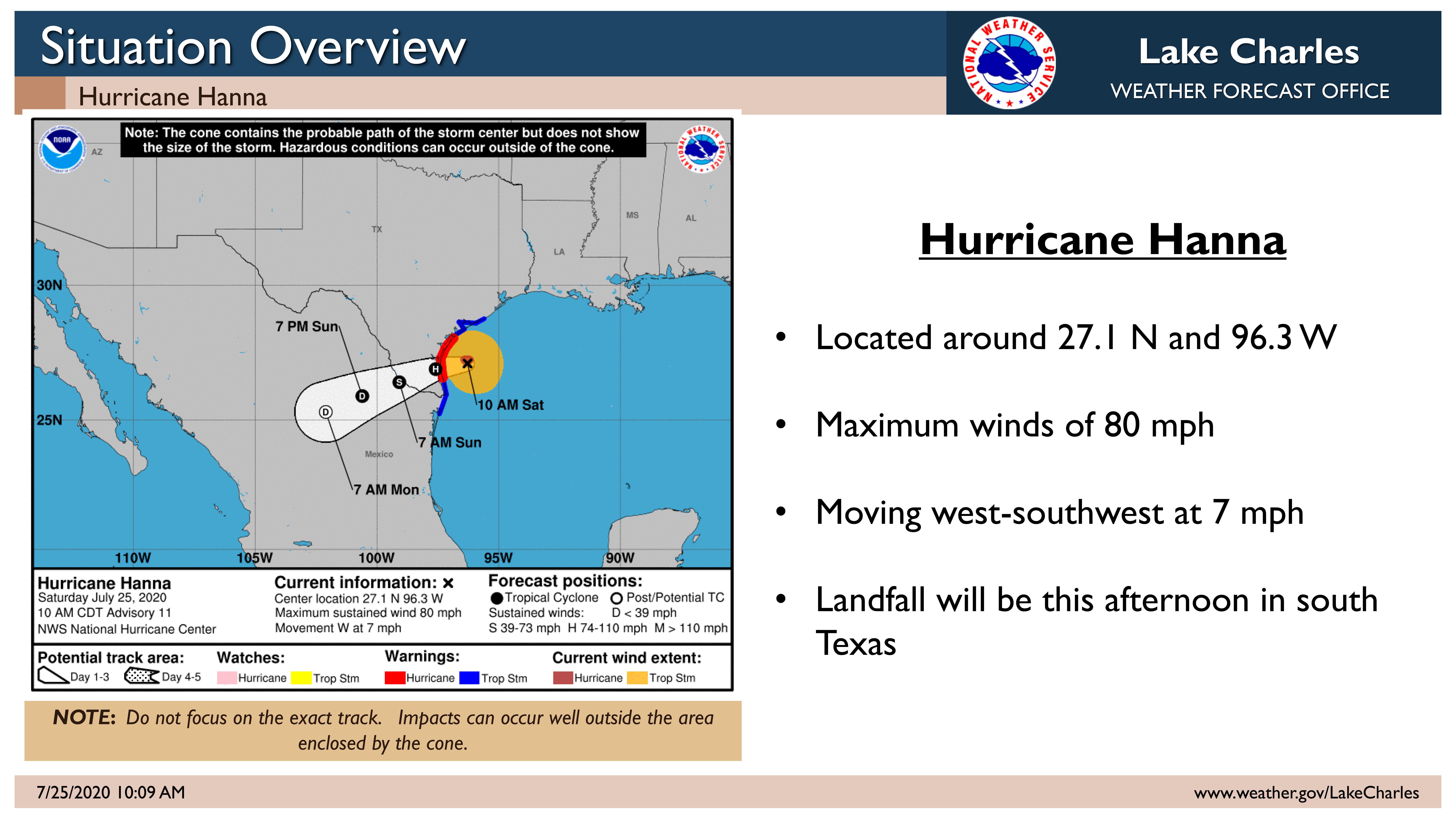
Hanna is a category one hurricane. Landfall projection is this afternoon near Port Mansfield, TX. For our region, wind gusts will be as high as 30 to 40 mph in the rain bands.
Another one to three inches of rain is expected, mainly along and south of the I-10 corridor of southeast Texas and southern Louisiana today and Sunday.
Another one to three inches of rain is expected, mainly along and south of the I-10 corridor of southeast Texas and southern Louisiana today and Sunday.
Tides are between 1.5 and 2.5 feet above MHHW this morning across coastal sections of southeast Texas and southwest Louisiana. Although the tides will be a little lower during the next high tide this evening and again Sunday morning, minor coastal flooding is expected during high tides.
Locations to be alert for minor coastal flooding include: Sabine Pass, Rainbow Bridge, downtown Orange, Deatonville, Hackberry, downtown Cameron, Intracoastal City, Delcambre, Cypremort Point, and Burns Point.
Elsewhere in the tropics, Tropical Storm Gonzalo is weak and will dissipate this weekend in the Caribbean. A tropical wave further out in the Atlantic has a medium 60% chance for development by the middle to the end of next week, as it approaches the Caribbean. It is too early to say if this potential system will reach the Gulf of Mexico.