NWS Lake Charles weather update: Tue 2.11.20
Published 12:36 pm Tuesday, February 11, 2020
1 of 2
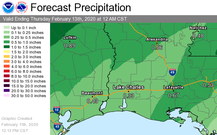
PRESS RELEASE — The National Weather Service is monitoring a stationary front that extends from Cameron to Lafayette. This frontal boundary will move further north this afternoon and tonight. On Wednesday, a cold front will move west to east across our region during the day, producing some showers and thunderstorms,.
We are expecting less than an inch of rain area-wide from this system over the next 24 to 36 hours. Some localized spots could see a couple of inches.
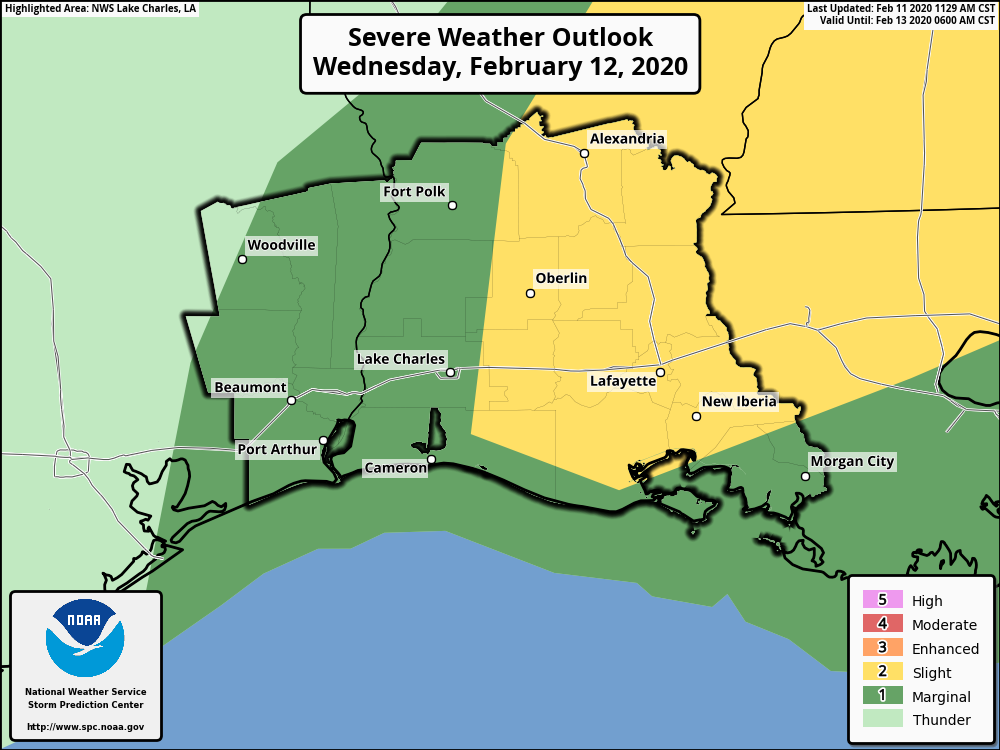
The severe weather threat for Wednesday is a marginal 5% for southeast Texas and western Louisiana, and a slight 15% for south central and parts of central Louisiana. The primary thunderstorm threats on Wednesday will be isolated tornadoes and damaging winds.
In addition, sea fog will continue to be a problem today and tonight for mariners in coastal lakes and bays, as well as out in the northwestern Gulf of Mexico. Visibilities will improve behind the cold front late Wednesday.