Special weather update
Published 3:08 pm Monday, April 18, 2016
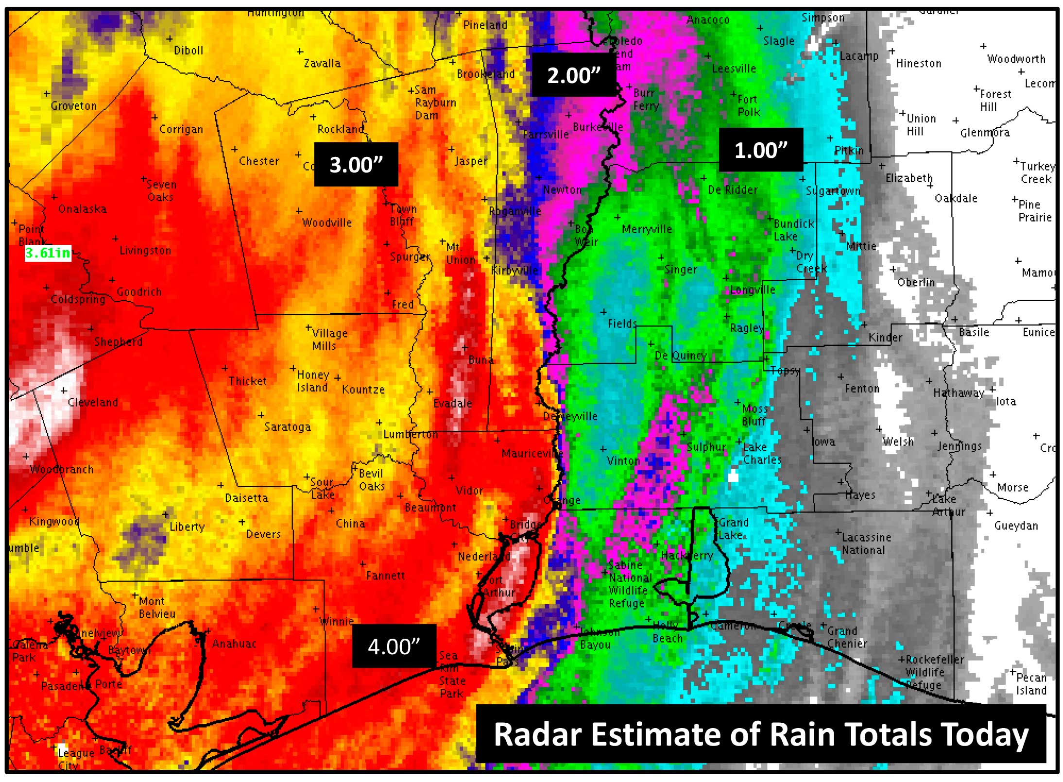
The National Weather Service in Lake Charles has seen some parts of southeast Texas receive 4 to 8 inches of rain today, resulting in street flooding in parts of Jefferson, Orange, Jasper, and Newton counties. Rain will move across Louisiana this afternoon, but only produce less than an inch of rain as it moves across south central Louisiana later this evening.
An additional one to three inches of rain is expected tonight through Thursday. The lower rain totals will be in south central Louisiana and the highest numbers will be in southeast Texas. Here is a more descriptive breakdown.
There will be another round of rain starting in southeast Texas Tuesday morning, where they could see an inch of rain during the day on Tuesday. it should be less than what they saw today, but it could cause some additional street flooding in areas of poor drainage. Southwest Louisiana and central Louisiana will see less than inch of rain, and south central Louisiana will see less than a quarter inch of rain on Tuesday.
Wednesday’s rain totals look to be less than Tuesday’s, with less than an inch of rain expected area-wide. Southeast Texas to central Louisiana will see the highest numbers of three quarters of an inch of rain, with less amounts in southwest and south central Louisiana.
Rain will be ending Thursday across the forecast area.
Due to the rainfall, minor river flooding is expected this week on Pine Island Bayou near Sour Lake, Neches River near Beaumont, Sabine River near Deweyville to Orange, and Calcasieu River near Old Town Bay and Salt Water Barrier.
Due to the strong onshore flow and stormy weather, tides will continue to run above normal and cause minor coastal flooding during high tides. It will also slow down drainage on the rain in parts of Jefferson and Orange counties tonight and tomorrow.